Keeping abreast of the latest news is crucial, especially in a dynamic and high-risk environment like the maritime sector. By being well-informed about recent developments, regulations and best practices, employees and companies can learn from each other, improve safety and work more efficiently.
Click and read on to learn more about the latest safety guidelines, innovative techniques and essential measures that contribute to a safe working environment at sea. Stay prepared and well-informed with our insights.
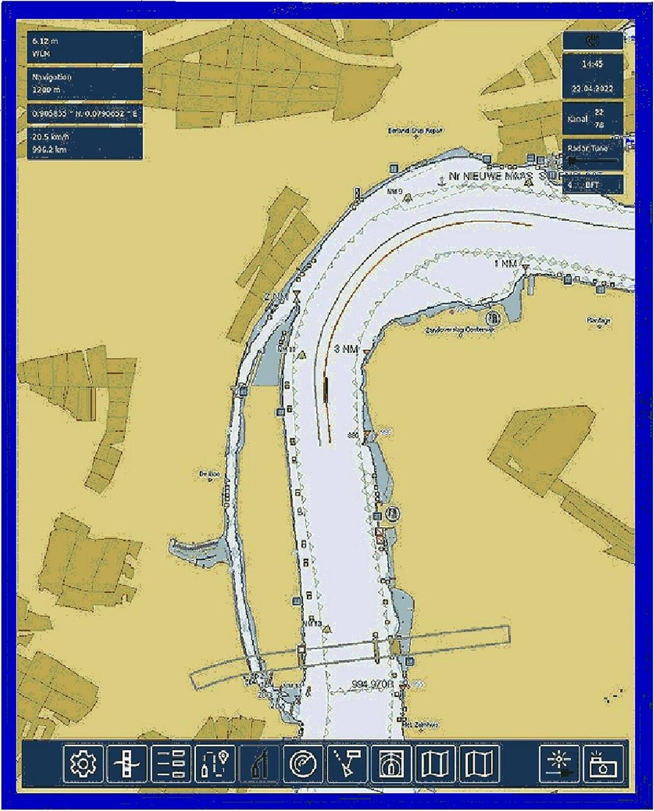
Many electronic charts can store a route to be sailed and automatically steer the ship so that it stays on the intended line. The intention is that ships in the vicinity also see the same line.
Avoiding collisions
The purpose of the new ‘intention sharing’ system is to share the stored intended route of one ship with all other ships in the vicinity. This not only allows other ships to calculate the current course and speed, but also informs them of any intended course changes. It is now possible for the electronics to respond to the intentions of other ships.
Course changes can then be made to avoid collisions. Thanks to other data, for example from the electronic chart, it is known where the fairway ends and the quay or shoals begin. This means that the track plotter will not steer the ship too quickly onto the rocks in order to avoid a collision. It is clear that this automated method will not only relieve the responsible skipper or helmsman on board of a lot of work and worry. It also brings unmanned sailing a lot closer. Ships can complete a planned voyage with a further reduced risk of collisions, not only with other ships, but also with structures.
Shortest distance
This prompted the decision to have the calculation performed by technology. The ARPA was able to calculate the distance and course of the object from the movement of the dots on the radar screen. On top of that came the speed of the object. But what really mattered were the CPA and the TCPA, the ‘Closest Point of Approach’ and the ‘Time of Closest Point of Approach’, in short, the shortest distance that would arise between the two ships and the time at which that would happen. If this shortest distance were zero, there would be an imminent collision. The ARPA also had a number of alarms to indicate that something dangerous was approaching.
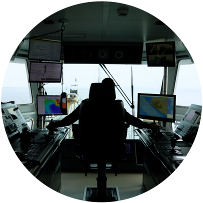
But technology has not stood still and more has become possible. On board many ships, the track pilot has now become the center of navigation. It is an electronic chart on which all possible information can be summarized much more clearly than on the radar screen. The track plotter can also communicate with the ship's own GPS navigator, radar, and AIS receiver. These connections make it possible to see not only dots on the radar screen, but all possible data about all ships in the vicinity.
In addition to name, size, and destination, real-time data such as the current course and speed of other ships is also available. The fact that the possibilities now go a step further is partly due to the track plotter's ability to store previously sailed routes or to enter routes that are yet to be sailed. Because the track plotter can also issue steering commands, a ship can now automatically make the exact same journey multiple times with minimal human intervention. Intervention by the helmsman or skipper and switching to manual steering remains possible, of course.
Photo for illustration purposes
Sailing and navigating have increasingly become a matter of looking at screens rather than looking outside. But screens often show more information than can be seen outside.
© Images CreaTeam

In 1956, the ship Andrea Doria collided with another vessel in thick fog. This incident prompted a worldwide push to upgrade radar equipment with intelligent features designed to prevent such collisions in the future. This led to the development of ARPA, which was soon made mandatory on various ships. Today, ARPA is no longer sufficient, and further automation of safe navigation is being sought. The latest development is ‘intention sharing’.
First of all: what is ARPA? It is the abbreviation for ‘Automatic Radar Plotting Aid’. In the early years of radar, the navigator had to plot the changing dots on the screen with paper and pencil to see if the ships were at risk of collision at their current courses and speeds.
These calculations were not easy. Crossing course lines were perhaps the easiest to predict, but the moments at which these crossings would take place were more difficult to calculate. Perhaps one ship would already be miles away when the other ship crossed its course line. In that case, there would be no danger. But it could also be the case that the ships would change course or speed prematurely, meaning that the entire calculation would have to be redone.

'Third Maasvlakte' does not cover the scope
According to those involved, the name ‘Third Maasvlakte’ does not fully cover the scope of the possible expansion of the port towards the sea. The Second Maasvlakte was constructed to make room for logistics, but now a completely different issue is on the agenda: the energy transition, which requires space for (wind) energy, perhaps hydrogen plants or even a nuclear power plant.
Not only is the purpose of the possible third expansion of the Maasvlakte different, but the scale is also likely to be different. Whether the expansion will take place at all, and in what form, depends on lengthy studies.
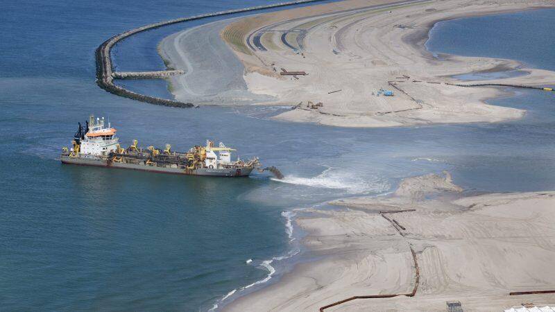
Photo for illustrative purposes
Foto: ANP. Ter illustratie. De aanleg van de Tweede Maasvlakte met zandopspuitingen in 2012.
Conservationists are unwilling to discuss the expansion of the Port of Rotterdam into the sea until the nature compensation agreed upon more than twenty years ago during the construction of Maasvlakte 2 has been realized. This is the position of various nature conservation organizations, now that the national government and the Rotterdam region are investigating the expansion of Maasvlakte.
Natuurmonumenten, the World Wildlife Fund, and Natuur en Milieufederatie Zuid-Holland, among others, have been involved in legal proceedings with the government for years over compensation for the nature lost due to the construction of the Maasvlakte.
The organizations are ‘not in favor’ of further expansion. ‘But if this proves necessary in the future, for example for the energy transition, then one thing is very clear: we will only discuss new expansions of the port once the nature compensation for Maasvlakte 2 has been realized.’ The Council of State is expected to rule on this long-running case within a few weeks.
The call from nature conservation groups is not new: when the province of South Holland organized a conference in May last year on the possible expansion of the port of Rotterdam into the sea, then known as Third Maasvlakte, the Natuurmonumenten association also said that the loss of nature in Second Maasvlakte must first be compensated.
the Dutch Association of Insurers
Image: Verbond van Verzekeraars
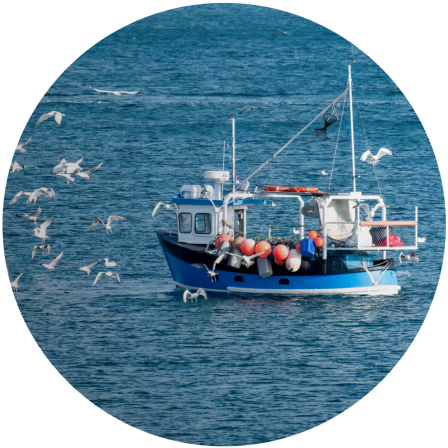
The FAO (UN Food and Agriculture Organization) has published new international guidelines to improve the safety of small fishing vessels. These guidelines are intended to prevent accidents, reduce damage and loss in small-scale fisheries, and make the fishing profession safer.
The focus is on practical inspections of fishing boats up to 12 meters in length, with attention to the hull, stability, machinery, and safety equipment. The guidelines also help fishermen assess their own vessels, which contributes to greater safety awareness and risk management. The guidelines also support access to insurance for fishermen worldwide, especially in developing countries, and are in line with existing SSF guidelines for sustainable fishing.
intention sharing
Keeping abreast of the latest news is crucial, especially in a dynamic and high-risk environment like the maritime sector. By being well-informed about recent developments, regulations and best practices, employees and companies can learn from each other, improve safety and work more efficiently.
Click and read on to learn more about the latest safety guidelines, innovative techniques and essential measures that contribute to a safe working environment at sea. Stay prepared and well-informed with our insights.
Avoiding collisions
The purpose of the new ‘intention sharing’ system is to share the stored intended route of one ship with all other ships in the vicinity. This not only allows other ships to calculate the current course and speed, but also informs them of any intended course changes. It is now possible for the electronics to respond to the intentions of other ships.
Course changes can then be made to avoid collisions. Thanks to other data, for example from the electronic chart, it is known where the fairway ends and the quay or shoals begin. This means that the track plotter will not steer the ship too quickly onto the rocks in order to avoid a collision. It is clear that this automated method will not only relieve the responsible skipper or helmsman on board of a lot of work and worry. It also brings unmanned sailing a lot closer. Ships can complete a planned voyage with a further reduced risk of collisions, not only with other ships, but also with structures.
Many electronic charts can store a route to be sailed and automatically steer the ship so that it stays on the intended line. The intention is that ships in the vicinity also see the same line.

Shortest distance
This prompted the decision to have the calculation performed by technology. The ARPA was able to calculate the distance and course of the object from the movement of the dots on the radar screen. On top of that came the speed of the object. But what really mattered were the CPA and the TCPA, the ‘Closest Point of Approach’ and the ‘Time of Closest Point of Approach’, in short, the shortest distance that would arise between the two ships and the time at which that would happen. If this shortest distance were zero, there would be an imminent collision. The ARPA also had a number of alarms to indicate that something dangerous was approaching.
But technology has not stood still and more has become possible. On board many ships, the track pilot has now become the center of navigation. It is an electronic chart on which all possible information can be summarized much more clearly than on the radar screen. The track plotter can also communicate with the ship's own GPS navigator, radar, and AIS receiver. These connections make it possible to see not only dots on the radar screen, but all possible data about all ships in the vicinity.
In addition to name, size, and destination, real-time data such as the current course and speed of other ships is also available. The fact that the possibilities now go a step further is partly due to the track plotter's ability to store previously sailed routes or to enter routes that are yet to be sailed. Because the track plotter can also issue steering commands, a ship can now automatically make the exact same journey multiple times with minimal human intervention. Intervention by the helmsman or skipper and switching to manual steering remains possible, of course.
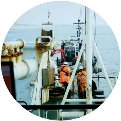
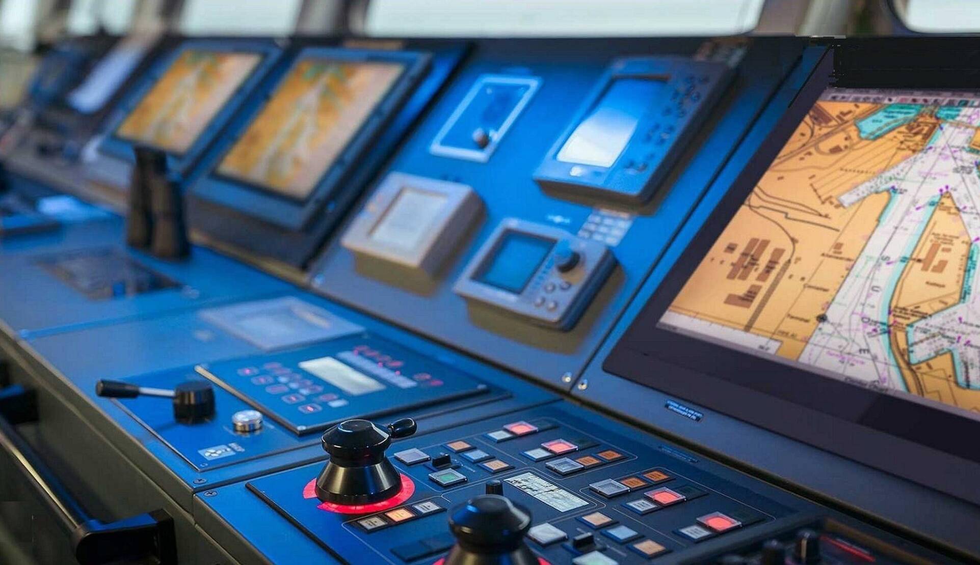
Photo for illustration purposes
Sailing and navigating have increasingly become a matter of looking at screens rather than looking outside. But screens often show more information than can be seen outside.
© Images CreaTeam
In 1956, the ship Andrea Doria collided with another vessel in thick fog. This incident prompted a worldwide push to upgrade radar equipment with intelligent features designed to prevent such collisions in the future. This led to the development of ARPA, which was soon made mandatory on various ships. Today, ARPA is no longer sufficient, and further automation of safe navigation is being sought. The latest development is ‘intention sharing’.
First of all: what is ARPA? It is the abbreviation for ‘Automatic Radar Plotting Aid’. In the early years of radar, the navigator had to plot the changing dots on the screen with paper and pencil to see if the ships were at risk of collision at their current courses and speeds.
These calculations were not easy. Crossing course lines were perhaps the easiest to predict, but the moments at which these crossings would take place were more difficult to calculate. Perhaps one ship would already be miles away when the other ship crossed its course line. In that case, there would be no danger. But it could also be the case that the ships would change course or speed prematurely, meaning that the entire calculation would have to be redone.

'Third Maasvlakte' does not cover the scope
According to those involved, the name ‘Third Maasvlakte’ does not fully cover the scope of the possible expansion of the port towards the sea. The Second Maasvlakte was constructed to make room for logistics, but now a completely different issue is on the agenda: the energy transition, which requires space for (wind) energy, perhaps hydrogen plants or even a nuclear power plant.
Not only is the purpose of the possible third expansion of the Maasvlakte different, but the scale is also likely to be different. Whether the expansion will take place at all, and in what form, depends on lengthy studies.
Foto: ANP. Ter illustratie. De aanleg van de Tweede Maasvlakte met zandopspuitingen in 2012.

Conservationists are unwilling to discuss the expansion of the Port of Rotterdam into the sea until the nature compensation agreed upon more than twenty years ago during the construction of Maasvlakte 2 has been realized. This is the position of various nature conservation organizations, now that the national government and the Rotterdam region are investigating the expansion of Maasvlakte.
Natuurmonumenten, the World Wildlife Fund, and Natuur en Milieufederatie Zuid-Holland, among others, have been involved in legal proceedings with the government for years over compensation for the nature lost due to the construction of the Maasvlakte.
The organizations are ‘not in favor’ of further expansion. ‘But if this proves necessary in the future, for example for the energy transition, then one thing is very clear: we will only discuss new expansions of the port once the nature compensation for Maasvlakte 2 has been realized.’ The Council of State is expected to rule on this long-running case within a few weeks.
The call from nature conservation groups is not new: when the province of South Holland organized a conference in May last year on the possible expansion of the port of Rotterdam into the sea, then known as Third Maasvlakte, the Natuurmonumenten association also said that the loss of nature in Second Maasvlakte must first be compensated.
the Dutch Association of Insurers
The FAO (UN Food and Agriculture Organization) has published new international guidelines to improve the safety of small fishing vessels. These guidelines are intended to prevent accidents, reduce damage and loss in small-scale fisheries, and make the fishing profession safer.
The focus is on practical inspections of fishing boats up to 12 meters in length, with attention to the hull, stability, machinery, and safety equipment. The guidelines also help fishermen assess their own vessels, which contributes to greater safety awareness and risk management. The guidelines also support access to insurance for fishermen worldwide, especially in developing countries, and are in line with existing SSF guidelines for sustainable fishing.